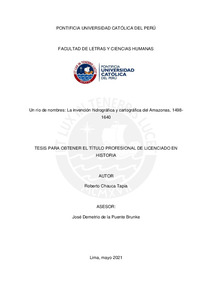
Un río de nombres: La invención hidrográfica y cartográfica del Amazonas, 1498- 1640
| dc.contributor.advisor | De la Puente Brunke, José Demetrio | |
| dc.contributor.author | Chauca Tapia, Roberto | |
| dc.date.accessioned | 2021-11-04T23:14:47Z | |
| dc.date.available | 2021-11-04T23:14:47Z | |
| dc.date.created | 2021 | |
| dc.date.issued | 2021-11-04 | |
| dc.identifier.uri | http://hdl.handle.net/20.500.12404/20785 | |
| dc.description.abstract | Este tesis examina la configuración del conocimiento cartográfico e hidrográfico del río que hoy conocemos como "Amazonas" entre 1498 y 1640. Durante este período fundacional el río encarnó múltiples identidades y nomenclaturas—Mar Dulce, Río Grande, Marañón, Orellana y, eventualmente, Amazonas. Este estudio plantea que esta ambivalencia fundacional de la Amazonía fue el resultado del uso de diferentes convenciones espaciales para la definición cartográfica e hidrográfica de los ríos en un contexto de disputa imperial entre agentes de España, Portugal, Francia e Inglaterra por la colonización de los trópicos sudamericanos, lo que resultó en la imposibilidad de nombrar un único “Amazonas” durante el largo siglo XVI. Por ello, esta tesis sostiene que la cartografía y la hidrografía funcionaron no solo como instrumentos de conocimiento y representación de la naturaleza sino también como herramientas para colonizar el interior amazónico del Nuevo Mundo. | es_ES |
| dc.description.abstract | This thesis examines the configuration of the cartographic and hydrographic knowledge of the river that we now know as "Amazonas" between 1498 and 1640. During this foundational period the river embodied multiple identities and nomenclatures — Mar Dulce, Río Grande, Marañón, Orellana and, eventually, Amazonas. This study proposes that this foundational ambivalence of the Amazon was the result of the use of different spatial conventions for the cartographic and hydrographic definition of rivers in a context of imperial dispute between agents of Spain, Portugal, France, and England for the colonization of the South American tropics, which resulted in the impossibility of naming a single normative "Amazon" during the long 16th century. Therefore, this thesis maintains that cartography and hydrography functioned not only as instruments of knowledge and representation of nature, but also as tools to colonize the Amazonian interior of the New World. | es_ES |
| dc.language.iso | spa | es_ES |
| dc.publisher | Pontificia Universidad Católica del Perú | es_ES |
| dc.rights | Atribución-NoComercial-SinDerivadas 2.5 Perú | * |
| dc.rights | info:eu-repo/semantics/openAccess | es_ES |
| dc.rights.uri | https://creativecommons.org/licenses/by-nc-nd/2.5/pe/ | * |
| dc.subject | Amazonas, Río--Historia | es_ES |
| dc.subject | Amazonas, Río--Descubrimiento y exploraciones | es_ES |
| dc.title | Un río de nombres: La invención hidrográfica y cartográfica del Amazonas, 1498- 1640 | es_ES |
| dc.type | info:eu-repo/semantics/bachelorThesis | es_ES |
| thesis.degree.name | Licenciado en Historia | es_ES |
| thesis.degree.level | Título Profesional | es_ES |
| thesis.degree.grantor | Pontificia Universidad Católica del Perú. Facultad de Letras y Ciencias Humanas | es_ES |
| thesis.degree.discipline | Historia | es_ES |
| renati.advisor.dni | 07969788 | |
| renati.advisor.orcid | https://orcid.org/0000-0002-8794-8034 | es_ES |
| renati.author.dni | 41059382 | |
| renati.discipline | 222066 | es_ES |
| renati.juror | Lossio Chávez, Jorge Luis | es_ES |
| renati.juror | De la Puente Brunke, José Demetrio | es_ES |
| renati.juror | Gálvez Peña, Carlos Martín | es_ES |
| renati.level | https://purl.org/pe-repo/renati/level#tituloProfesional | es_ES |
| renati.type | https://purl.org/pe-repo/renati/type#tesis | es_ES |
| dc.date.EmbargoEnd | 2023-10-05 | |
| dc.publisher.country | PE | es_ES |
| dc.subject.ocde | https://purl.org/pe-repo/ocde/ford#6.01.01 | es_ES |
Files in this item
This item appears in the following Collection(s)

Except where otherwise noted, this item's license is described as Atribución-NoComercial-SinDerivadas 2.5 Perú